Maps > South Island Maps > Hump Ridge Track map
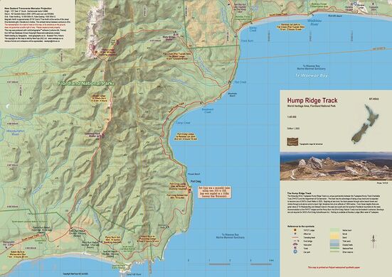
Hump Ridge Track New !!
|
Edition 1 2022. Scale 1:45 000
A3 format. Printed on waterproof synthetic paper. 
|
The three-day 61km Tuatapere Hump Ridge Track is a unique partnership between the Tuatapere Hump Track Charitable Trust (THTCT) and the Department of Conservation. The track is expected to become one of DOC's Great Walks in 2023. Beginning at sea level, the track passes through native beech forest and climbs through sub-alpine scrub to reach high limestone tors at an altitude of 1000 metres. Accommodation at the THTCT lodges and the Percy Burn Hut (Port Craig Viaduct Trust) must be booked in advance. Bookings are not required for DOC's Port Craig Schoolhouse Hut. Parking is available at Rarakau Lodge 28km west of Tuatapere.
Overseas? Stanfords in the UK also sell a selection of NewTopo Maps online. In Australia try the Chart and Map Shop in Fremantle, WA, or the Geographica map centre in Hobart, Tasmania. |
Please read our terms & conditions, including delivery and return information.
Orders are normally despatched within 24 hours. NZPost delivery can take 7-10 days.
Orders are normally despatched within 24 hours. NZPost delivery can take 7-10 days.


